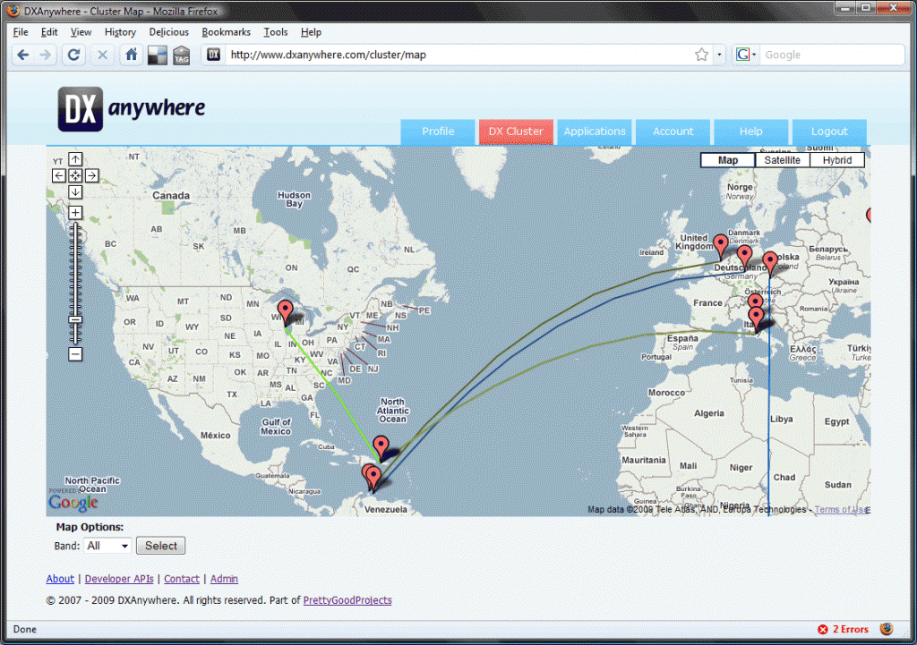
I spent some time yesterday adding a new feature to DXAnywhere this being the ability to see DX Cluster spots on a Google Map, after a little researching on how the Google Maps API works I had a prototype on-line before lunch and got feed back within a couple of minutes of posting the website address on Twitter (1,2).

After this I set about developing the system further adding the Great circle lines and the ability to select a band you’d like to monitor for spots, the system actually displays the last 10 spots and refreshes every 20 seconds so the information is relativity current. Both the spotter and the dx station is plotted at the moment this is using the same style of pins but I hope to change this to ones a bit more amateur radio related.
After watching it for a couple of hours its been interesting to see whos being working K5D visually instead of looking at a data table. You can find the cluster map at http://www.dxanywhere.com/cluster/map while your there do take a look at the rest of the site theres lots on offer! more so when you register.
